First Maps
(A section of the NICEVILLE, FLORIDA - Online History Center)
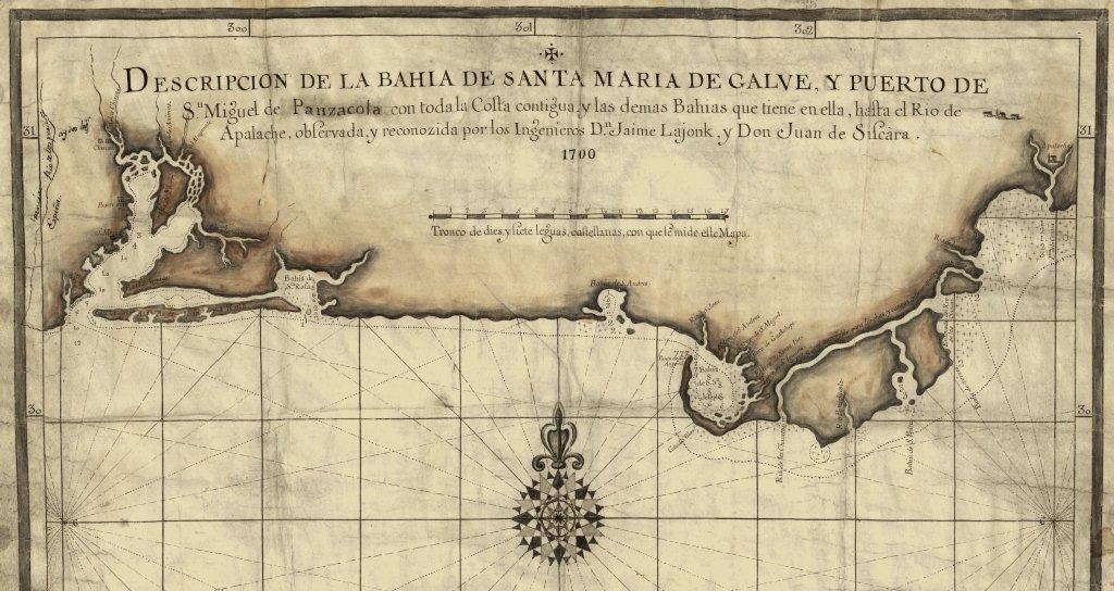
(Note: 1700 Panzacola Bahia de Santa Maria de Galve map showing today's Choctawhatchee Bay as Santa Rosa Bay)
This map is of the Panhandle of Florida from 1700 and has been used by historians in documenting the history of Pensacola. Of important interest to the history of Niceville is that Choctawhatchee Bay is on this map, just east of Pensacola labeled as Bahia de Santa Rosa "Rofa". The source of this map is The Library of Congress website.
Additionally: "This is a manuscript map, washed in round the coast with elaborate compass rose, navigation lines, and lines of latitude and longitude. It is on parchment 20x27, and runs from the Rio Perdido Punta de la Casina. On the west side of Perdido it gives Francia (France), and on the east side Espana (Spain). The map is, therefore, contemporary evidence of boundary". Source: The Gulf States Historical Magazine, Volume I July 1902-May 1903 edited by Thomas McAdory Owen, Joel Campbell DuBose. Bibliography Notes on Material Relating to the History of the Gulf States. By William Beer, Howard Memorial Library, New Orleans, La.
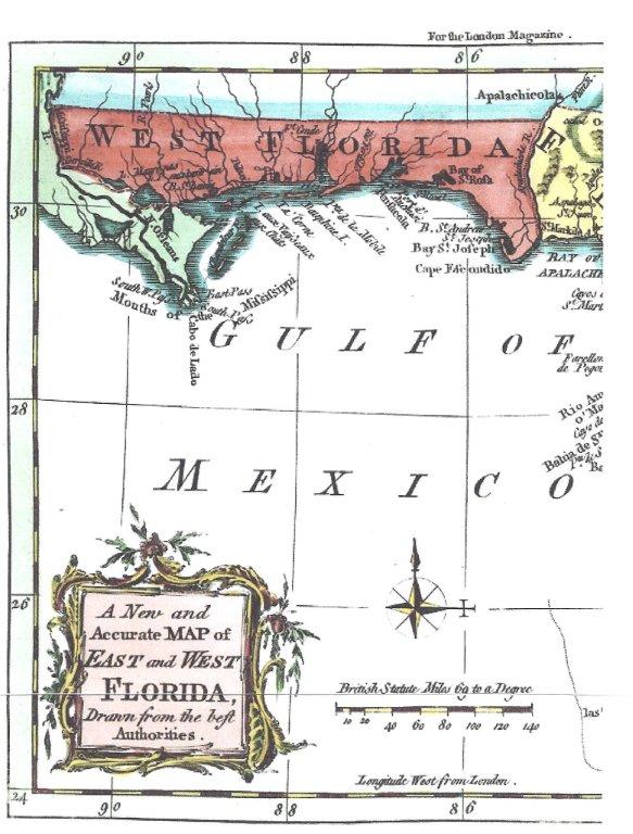
(Note: 1765 East and West Florida map showing Santa Rosa Bay as named by the Spanish)
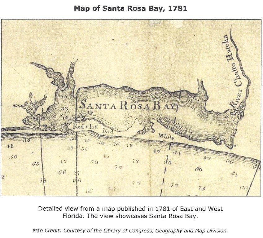
(Note: 1781 detail view of Santa Rosa Bay with red cliffs from map of East and West Florida)
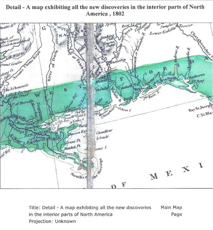
(Note: 1802 West Florida map showing Santa Rosa Bay)